Boating Access in Highland Beach: Intracoastal vs Ocean
January 15, 2026
January 15, 2026
Are you weighing Intracoastal convenience against oceanfront thrill in Highland Beach? You are not alone. If boating is part of your lifestyle, the type of waterfront you choose changes your daily routine, maintenance, insurance, and even how fast you can get offshore. This guide breaks down the real differences so you can buy confidently and match your dock to your boat and plans. Let’s dive in.
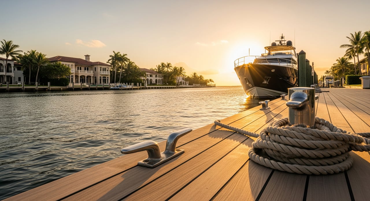
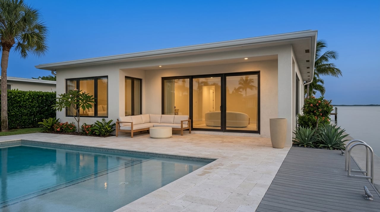
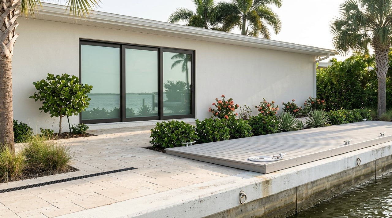
Highland Beach sits on a narrow barrier island in southern Palm Beach County. Homes on the east face the Atlantic Ocean; homes on the west face the Intracoastal Waterway. The ICW is a sheltered corridor running behind the barrier island, while direct ocean access involves transiting a federally maintained inlet or channel. Tides here are semi-diurnal, and while ranges are modest, wind, current, and shoaling can affect depth at docks and in channels.
Navigational ease. The ICW is typically calmer than the open Atlantic, which makes everyday boarding, docking, and cruising simpler. You can travel up and down the coast in protected water and choose your weather window for offshore trips. To reach the ocean, you will transit to a managed inlet or channel; actual time depends on your dock location and conditions.
Boat size and limits. Many ICW-side docks handle a wide range of vessels, but usable size depends on depth at mean low tide, dock length, and turning room. Shoaling in smaller canals can limit draft. Fixed bridges along your route elsewhere may set air-clearance limits, so confirm your clearances if you plan to cruise beyond the local area.
Wear and water conditions. Calmer water means less stress on hulls, lifts, and dock hardware. You may still encounter traffic wakes, especially near popular stretches. Routine inspection remains important, but exposure is generally lower than the oceanfront.
Recreation. Intracoastal access favors protected cruising, paddleboarding, kayaking, and inshore fishing. It is also convenient for day trips to nearby marinas and waterfront restaurants.
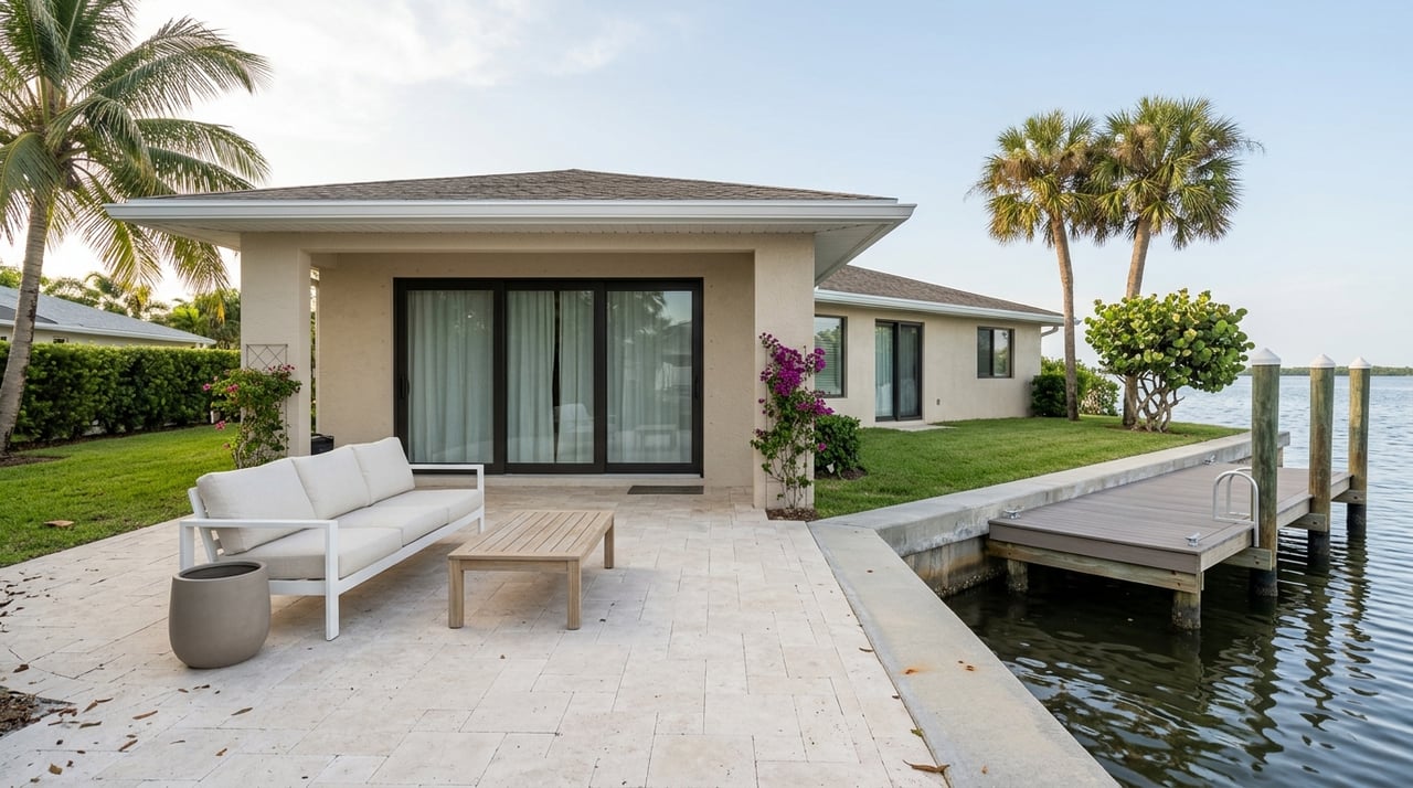
Property and insurance. ICW homes still face coastal flood and surge risk, yet the sheltered position can reduce some exposure compared with direct oceanfront. Review FEMA flood maps and consult an insurance agent for coverage and elevation requirements.
Direct offshore access. Oceanfront living puts you closer to blue water for offshore fishing, diving, and cruising. Ocean conditions can be more variable, so departures and returns depend on swell, wind, and currents.
Boat size and water depth. Some oceanfront properties can accommodate larger vessels if deeper water is adjacent and permits allow. Not all shorelines offer immediate deep water, and permitted dock lengths vary. Always confirm depth at mean low tide and permitted dimensions.
Wear and maintenance. Wave and swell exposure is greater, so you will want robust dock design, hardware, and more frequent checks for corrosion and storm wear. Budget for more maintenance over time.
Property and insurance. Oceanfront homes are more exposed to storm surge, wave runup, and salt spray, which affects construction standards and insurance underwriting. Expect different requirements than ICW-side properties and verify details with your insurer.
If you keep a boat on the ICW, your run offshore goes through a federally maintained inlet or channel. Channel markers, depth, and hazards can change due to shoaling and dredging. Before planning a route, check authoritative sources:
Transit time from any given dock varies. Ask for a practical estimate in minutes under typical conditions, and verify with recent soundings and local marina guidance.
Helpful references:
Most dock or seawall work requires municipal and county permits, and many projects need state submerged lands authorization. Work that affects federal channels or submerged resources may require a U.S. Army Corps permit. Multi-agency reviews are common and can take weeks to months, so build permitting time into your move or renovation plan.
Expect slow-speed zones near sensitive habitats and inlets. Protect seagrass and other marine habitat by avoiding prop scarring and unpermitted dredging. Always monitor NOAA marine weather and U.S. Coast Guard notices before a run, and plan for seasonal storms.
Use this list when you tour or request disclosures. Ask for measurements and documents in writing.
Your waterfront choice affects premiums and long-term upkeep. Oceanfront exposure often raises maintenance and insurance costs due to wave action and salt spray. ICW exposure may be lower but still demands flood planning.
For flood and surge context, consult FEMA Flood Insurance Rate Maps to understand elevation and zone. Ahead of hurricane season, confirm your storm plan, including haul-out capacity, marina policies, lines and hardware, and alternate mooring arrangements. Availability tightens quickly when a storm approaches.
You will find fuel docks, pump-out stations, shipyards, and transient slips across Palm Beach County, often concentrated in nearby cities. Since facilities and depths can change, call ahead to local marinas for current details on services, haul-out, and slip availability. This is especially important during peak season and storm threats.
Choose Intracoastal if you want calmer water for day-to-day use, easier docking, and flexible trip planning with occasional offshore runs. Choose oceanfront if fast access to blue water is your priority and you are prepared for higher exposure, maintenance, and stricter construction or insurance requirements. In both cases, verifying depth at mean low tide, permitted dock length, and real transit time to ocean access will help you make a confident decision.
Ready to compare specific properties and dock details side by side? Schedule a consultation with The Homeseeker Group for local insight, permit guidance, and a personalized plan.
References and helpful links:
Stay up to date on the latest real estate trends.

We’re more than agents—we’re local advocates, expert negotiators, and relentless problem-solvers. Let’s bring your real estate vision to life, together.